
Between the longitudinal section and the cross section, the difference is not limited to the orientation of the cutting line. These two technical documents reveal distinct information about a building, and their relevance depends on the geometry of the project, the terrain, and the requirements of the urban planning file. Understanding what each section measures allows for the selection of the right representation at the right time.
Longitudinal section and cross section: what each orientation reveals
| Criterion | Longitudinal section | Cross section |
|---|---|---|
| Cutting axis | In the direction of the building’s greatest length | Perpendicular to the main axis (width direction) |
| Preferred information | Sequence of spaces in depth, floor levels, relationship between entrance and back of the lot | Structural thickness of walls, spans of floors, ceiling height per bay |
| Relation to the terrain | Natural soil profile along the length of the lot, management of the longitudinal slope | Width layout, lateral excavations, relationship to neighboring properties |
| Common regulatory use | Visualize the project’s insertion into the slope and the continuity of the built environment | Check templates, prospects, and heights relative to boundary limits |
A rectangular building oriented north-south on a gently sloping site towards the south provides very different data depending on whether it is sliced lengthwise or widthwise. The longitudinal section shows how the project absorbs the slope, floor by floor, while the cross section exposes the structural span and the relationship to neighbors.
To delve deeper into longitudinal and cross sections in architecture, it is also necessary to distinguish these documents from plans and facades, which do not offer the same depth of reading.
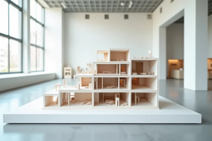
Architecture sections and BIM model: from 2D drawing to parametric model
The production of sections has profoundly changed with the adoption of BIM workflows. Longitudinal and cross sections are no longer manually drawn on a board: they are automatically generated from the digital model and updated in real-time with each project modification.
This integration into BIM alters the very nature of the document. A section extracted from a model contains metadata associated with the elements it crosses: material type, insulation thickness, fire resistance class. The drawing is no longer a graphic abstraction; it is a filtered view of a three-dimensional model shared among architects, structural engineers, and control offices.
Surveys by point cloud (lidar, drone photogrammetry) feed these models with an accurate digital terrain model. The longitudinal section of a rehabilitation project can thus overlay the actual profile of the existing ground and the project, with a fidelity that manual surveying could not achieve.
- The section plan remains a regulatory deliverable, but its source is now the BIM model, not an isolated file
- Structural engineers use the cross section to check load paths directly in the model
- Surveyors integrate terrain profiles into CAD/GIS software, which ensures the reliability of the natural terrain layout on the sections
Natural terrain and layout: what the section tells the urban planning service
In a building permit application, the section is not a graphical bonus. It is the document that allows the administration to verify that the project complies with height, prospect, and integration rules into the natural terrain.
The profile of the natural terrain before and after construction must appear on the section. This is what allows for measuring the actual height of the building, calculated not from the lowest floor but from the existing natural ground. On a sloping site, the difference between these two measurements can reach several meters, and this is often where permit refusals occur.
The longitudinal section is particularly telling on sloping lots because it shows the entire elevation change across the depth of the terrain. In contrast, the cross section documents compliance with lateral prospect rules, notably the distance between the building and the boundary limits.
A project can be compliant in plan and non-compliant in section. The site plan shows the footprint, but only the section reveals whether the height at the eaves or ridge exceeds the limits authorized by the local urban planning document.

Architectural ethics and reliability of sections in construction files
Since the decree of June 26, 2026, architects in France must justify continuous training, and complacent signatures are explicitly prohibited. This regulatory evolution has a direct impact on the graphic documents produced in urban planning files.
Specifically, the architect takes responsibility for the accuracy of the sections they sign. A section that minimizes the elevation change of the natural terrain, omits a semi-buried level, or underestimates the total height of the building exposes its author to disciplinary sanctions, in addition to consequences for the building permit.
With the old fee scales having been abandoned as part of this reform, economic pressure on agencies has not decreased. The temptation to produce simplified sections to save time exists, but the strengthening of the ethical framework makes this practice riskier.
- The longitudinal section of a project in clayey areas must show special foundations (underpinning, micropiles) to document the response to shrink-swell risks
- The cross section of an adjoining building must accurately represent the existing wall and any expansion joint
- Any technical element invisible in plan (crawl space, uninhabitable attics, parapet) must appear on at least one of the two sections
The section remains the only document in the urban planning file that simultaneously shows what is below the ground, at ground level, and above. Neither the site plan, nor the facades, nor insertion photographs provide this complete vertical information. For a construction or rehabilitation project, producing rigorous longitudinal and cross sections is not an administrative formality; it is the graphic proof that the building truly fits into its terrain.